For roughly 1,700 years, Polynesian seafarers stopped at Samoa and Tonga.
Then, in what became one of history’s most remarkable bursts of migration, they pushed east across the Pacific and settled island groups that had long remained beyond their reach. New research suggests that this dramatic shift may have been driven in part by a simple and brutal pressure on daily life, water was becoming scarce at home.
A team led by researchers from the University of Southampton and the University of East Anglia found evidence that the end of this so-called Long Pause coincided with an extended period of unusually dry conditions in Samoa and Tonga. At the same time, islands farther east appear to have been wetter, creating a sharp environmental contrast between homeland and destination.
The study, published in the Journal of Pacific Archaeology, draws on paleoclimate records, archaeological timing and climate modeling to argue that drought was not just background noise. It was likely one of the forces that helped push people into the open ocean.
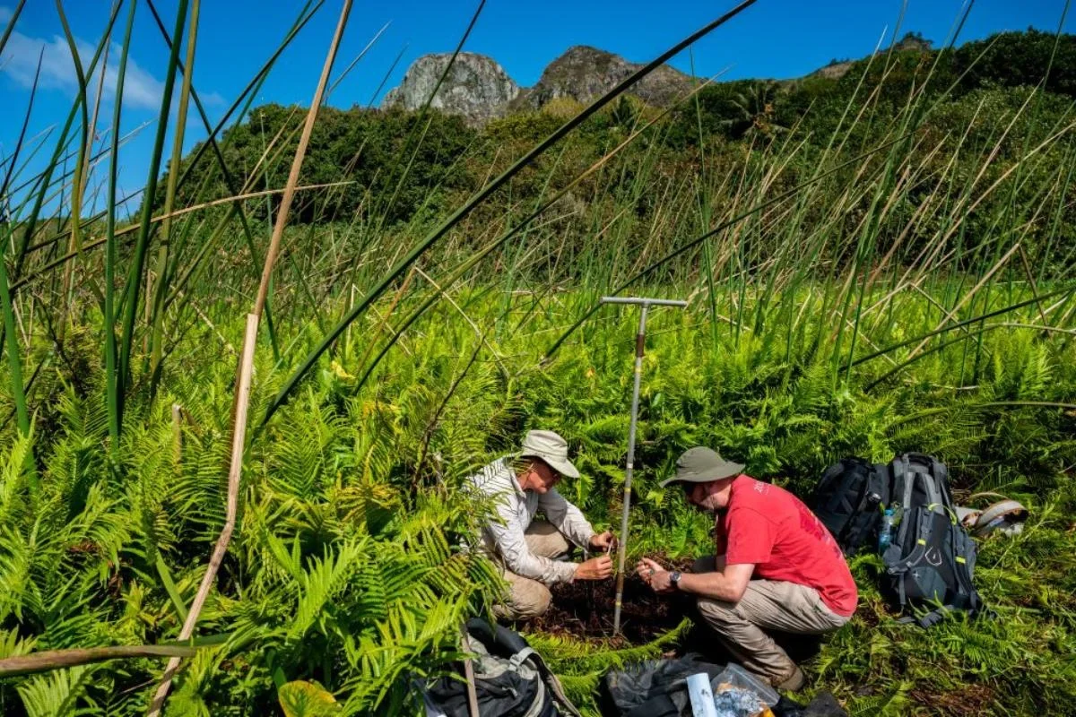
“We have confirmed the theory that the end of the Long Pause coincided with a period of mega drought in the homeland islands of Samoa and Tonga, and also a period of increasing rainfall in the receiving islands,” said David Sear, a professor of physical geography at the University of Southampton and the study’s lead author. “As they headed east, they found wetter islands with nobody on them.”
That does not mean climate acted alone. The authors also point to population pressure and possible improvements in canoe design and rigging. Still, the climate signal is striking, especially because it lines up with the timing of early settlement farther east.
To reconstruct past rainfall, the researchers analyzed mud cores taken from swamps and lakes in Samoa, Tonga, French Polynesia and the Cook Islands. Buried in those sediments were biochemical traces left behind by freshwater algae and leaves.
Those traces preserved hydrogen isotope ratios, which can be used to estimate how wet or dry conditions were when the material formed. Across several records, the team found signs of a severe dry phase just before and during the migration period.
“Hydrogen in rainwater contains heavier and lighter isotopes, the proportion of which is determined by the amount of precipitation in the tropics, which we were able to analyse in the mud,” said Mark Peaple, a research fellow in paleoclimate at Southampton who carried out the geochemical work. “So analysing the ancient biomarker fossils we can reconstruct rainfall changes from thousands of years.”
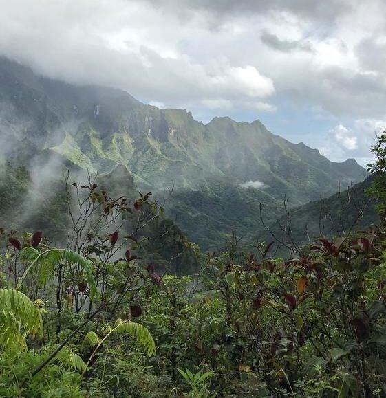
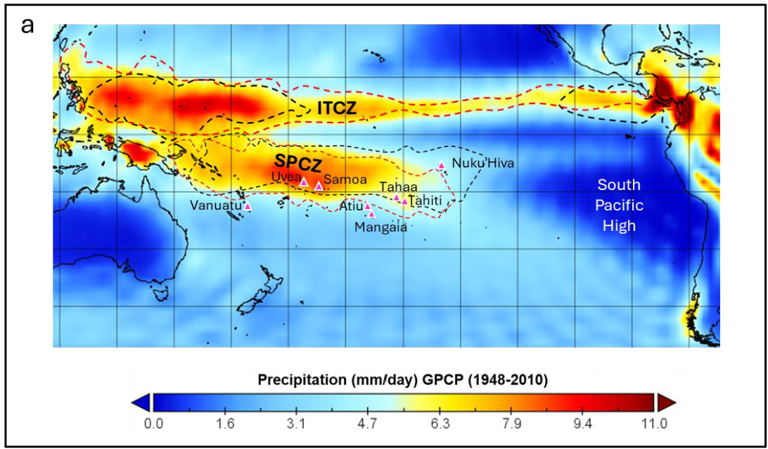
According to the study, the period around the end of the Long Pause was the driest in the last 2,000 years for Samoa and nearby islands in the southwestern-central South Pacific Convergence Zone, or SPCZ, a major tropical rain belt. The paper also found evidence of abrupt drying shocks around about 900 CE, among the largest seen in these records over the past 1,500 years.
The numbers were substantial. The authors report shock thresholds equivalent to about 329 millimeters of annual rainfall in Uvea, 595 millimeters in Samoa and 580 millimeters in Vanuatu. In percentage terms, that translated to mean annual rainfall declines of 15 percent in Uvea, 28 percent in Samoa and 33 percent in Vanuatu. Maximum reconstructed proxy rainfall shocks relative to the pre-industrial mean reached minus 30 percent in Vanuatu, minus 2 percent in Uvea and minus 53 percent in Samoa.
To understand why these islands dried out, the team turned to climate modeling.
Their simulations suggest that long-term changes in Pacific sea surface temperatures shifted the SPCZ eastward. That would have reduced rainfall over Samoa and Tonga while making conditions wetter farther east in parts of eastern Polynesia. The study links this pattern to an El Niño-like background state, with strong climate variability layered on top.
“Our research shows that changes in sea surface temperatures across the Pacific Ocean over many decades drove an eastward shift in the vast rain belt that lies over this whole region, causing the dry conditions found in Samoa and Tonga,” said Manoj Joshi, a professor of climate dynamics at the University of East Anglia.
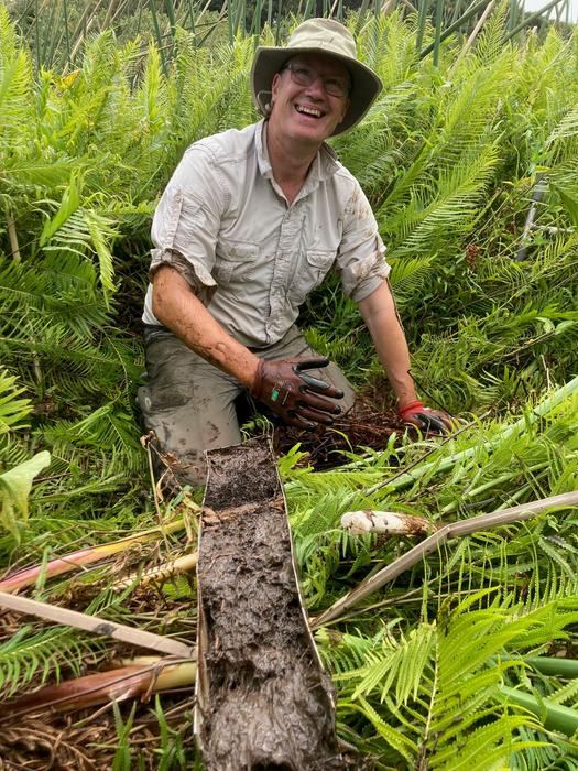
“The climate changes we identified would have transformed daily life on these islands,” he said. “Reduced rainfall would have affected freshwater availability, food production and the resilience of communities, creating powerful incentives for people to seek opportunities elsewhere.”
The timing matters. The paper places the earliest reliable arrivals in the Cook and Society Islands between about 950 and 1074 CE, with a median estimate near 1074 CE. That overlaps with a dry regional climate state and a period of strong hydroclimate instability between about 800 and 1050 CE.
Once migration began, settlement appears to have moved quickly. The supplied research summary describes an “explosion of migration” that spread people across the remaining island archipelagos of the South Pacific within about 250 years.
The authors are careful not to reduce a vast human story to weather alone.
In the discussion and conclusion, they describe a convergence of factors. Extended drought raised the pressure. Growing populations increased demand on food and water. Advances in voyaging technology may have improved the ability of canoes to sail into prevailing winds. Wetter conditions farther east may have made first landfalls more survivable.

Dan Skinner, a research fellow at East Anglia who carried out climate-model experiments, said the results show that long-lasting drought was “a definite factor in forcing this impressive migration.”
The paper stops short of claiming simple causation. “Coincidence in time is not causality,” the authors write, and they note that each island’s geology, topography, water access and local food base would have shaped how communities responded to stress.
That caution matters. Some islands concentrated people around especially productive land or reliable freshwater. Others had much tighter limits. The study argues that future work will need better local records, tighter chronologies and closer integration of paleoclimate, archaeology, population estimates and Pacific Island cultural knowledge.
Still, the larger pattern is hard to ignore. A long dry spell hit the western homeland islands as the eastern islands grew more favorable. In that setting, migration was not just a technical feat. It may also have been a rational response to worsening conditions.
The findings add climate pressure to the long-running debate over why Polynesian expansion resumed after such a long pause.
They suggest that migration was shaped not only by navigation skill and canoe technology, but also by shifts in water supply, agriculture and the basic ability of island communities to absorb prolonged drought.
More broadly, the work offers a deep-time example of how environmental stress can interact with population pressure and opportunity elsewhere, pushing even highly capable societies toward major movement rather than simple endurance.
Research findings are available online in the Journal of Pacific Archaeology.
The original story “The real story behind Moana: Why Polynesians suddenly sailed east” is published in The Brighter Side of News.
Like these kind of feel good stories? Get The Brighter Side of News’ newsletter.
The post The real story behind Moana: Why Polynesians suddenly sailed east appeared first on The Brighter Side of News.


Leave a comment
You must be logged in to post a comment.